Our Services
- Service Release Module
- Map Setting Module
- Cross-Platform Framework
- Customized Development Functions
- Terrain Analysis and Dynamic Data Display
- Object Collision Analysis


Spatial Application of Data Value
 3D ModelOverlay
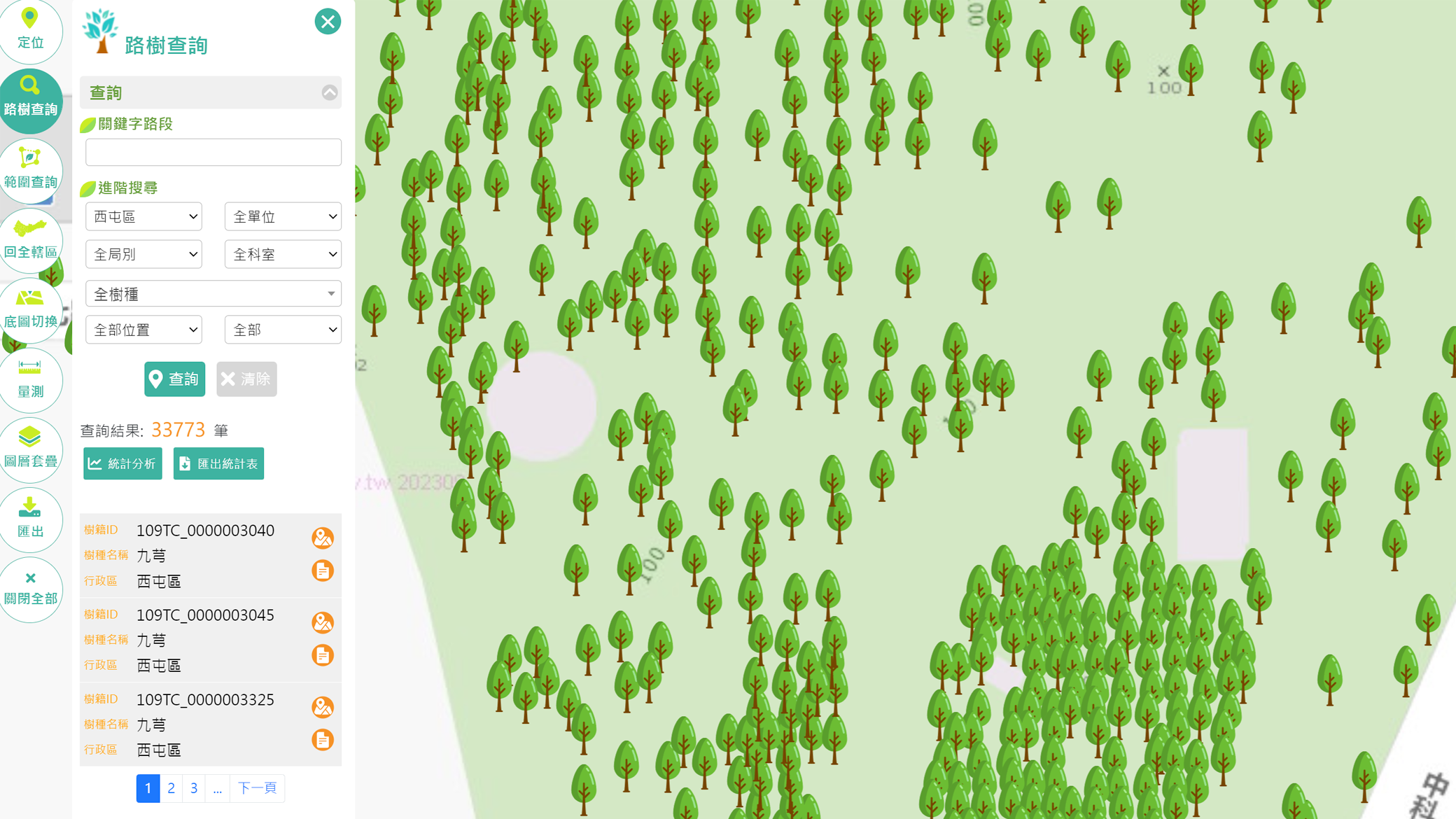
 MeasurementTools
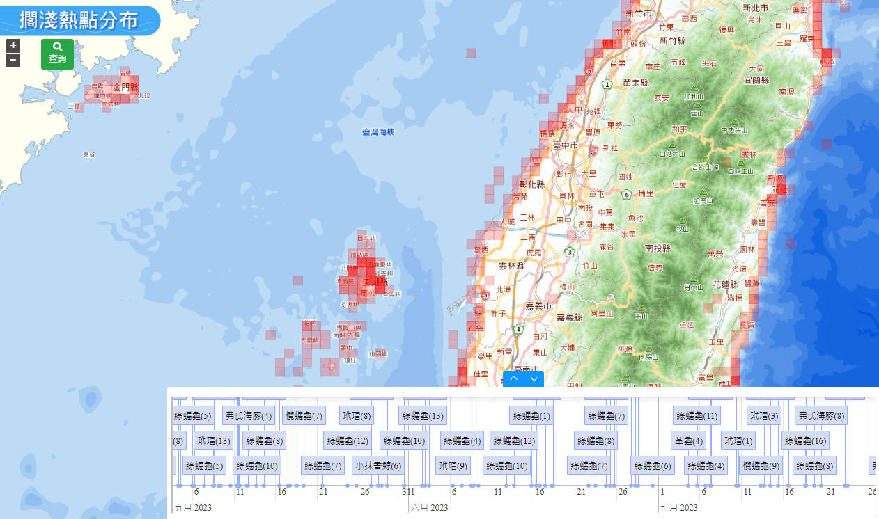
 Terrain Analysis
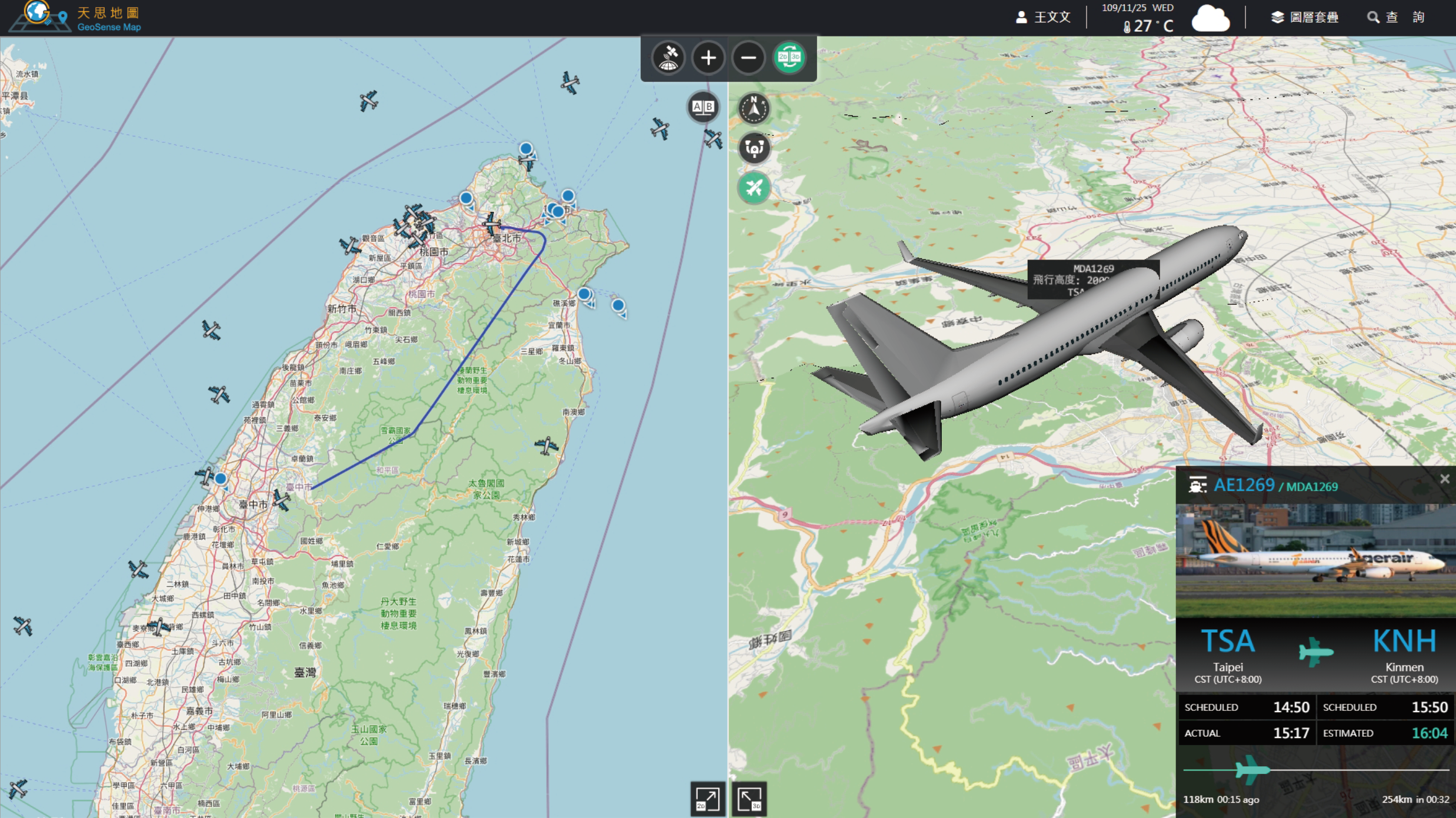
 Dynamic DataDisplay
 Digging Mode
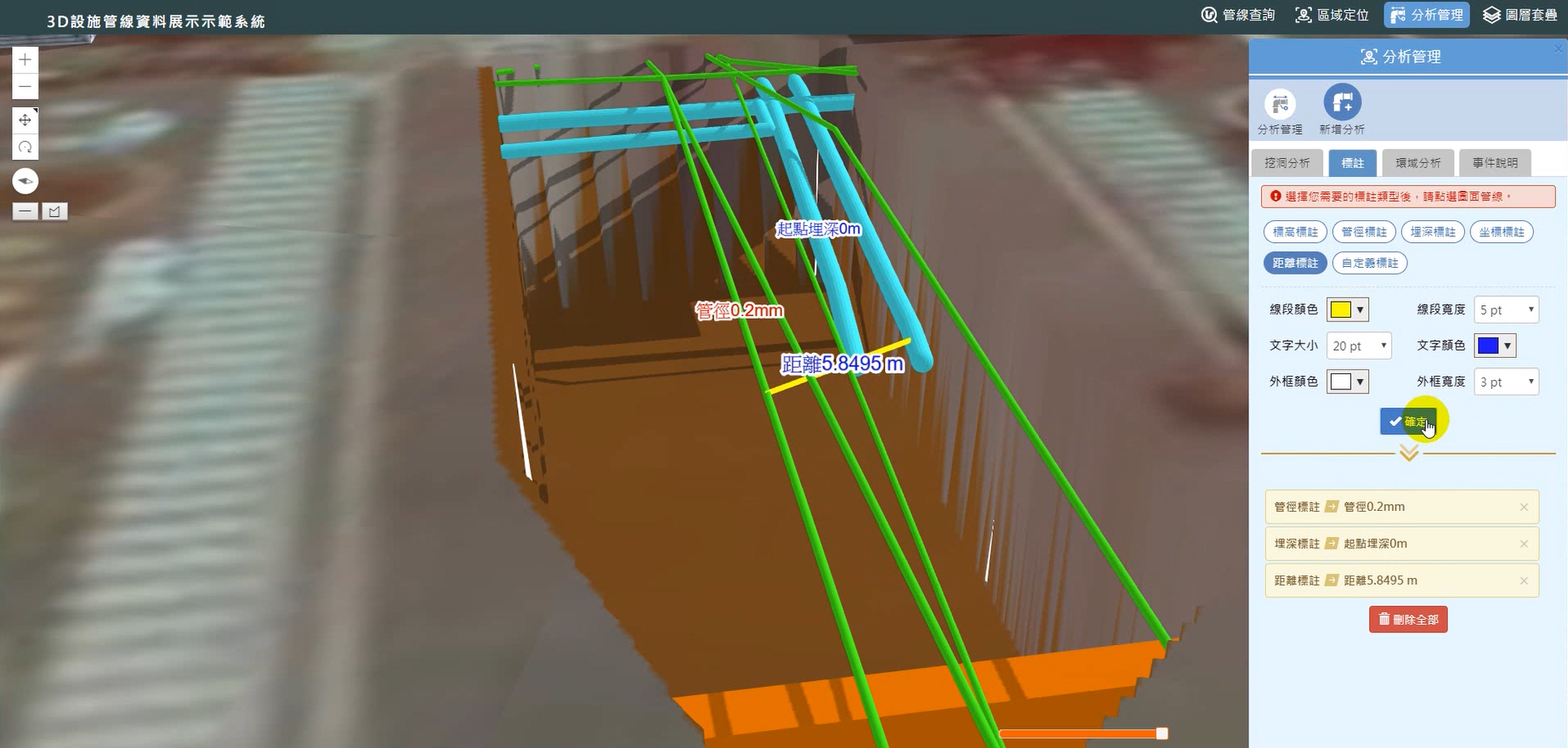
 Object CollisionAnalysis